Showing posts sorted by date for query Luray. Sort by relevance Show all posts

July 14, 2025

Dreams of Luray


I noticed this pretty new mural in Luray and stopped to get a picture of it. It’s on E. Main St. and shows some of the nearby attractions, including Luray Caverns and the “Singing Tower.” This is signed by the artist G. M. Grant.

I believe this replaces a previous mural which was peeling and fading.

Sharing with Monday Murals.

June 4, 2025

Mallards along Hawksbill Creek

Luray, VA


Mallard ducks looked unconcerned as people strolled past. I also saw other birds, including an egret flying by, but I couldn’t get pictures of them because I had Charlie on the leash. He’s usually on the move, sniffing here and there, and only the ducks seemed unafraid of him.

The creek had plenty of water in it, but if you see the debris level in the surrounding trees, you can see that it flooded recently. In fact, I read that the creek has a high level of E. coli right now, probably as a result of stormwater picking up manure and even sewage and carrying it into the creek. 


Parkland along the creek was created after a severe flood in 1966 proved that the riverbanks were not suitable for buildings. Open space and plants help prevent flooding by allowing stormwater to drain into the ground instead of rushing into the creek.


June 2, 2025

Pets and Art in Luray

Yesterday in Page County


Charlie’s friend Sadie is checking out a mural in Ruffner Plaza. I’ve actually shared this mural before, but it was in 2017. Let’s look at some other things.

Monday Mosaics /  Murals


We saw a small sign explaining that a cat that wandered around was not a stray. We did not have the privilege of meeting the cat, though.

There were some plaques telling the early history of the town, which was established in 1812 on land owned by the Ruffner family. Another plaque said that the first bluegrass festival was held at in Luray in 1961.


We also stopped at an art gallery that is west of town. It’s run by the folks who used to have the Warehouse Gallery. 


February 10, 2025

L-U-R-A-Y Mural

Along Hawksbill Creek


When I was planning to drive through Luray last week, I looked up the location of a new mural. That town has an impressive number of murals and I have photographed quite a few of them. I saw that there was a new one where Virginia Avenue crosses Hawksbill Creek. When I got there, I found a parking spot and realized I had been there before and had taken pictures of a mural under the bridge. But that was four years ago, so I decided to walk a little ways and see if there was another one.


I found it in the underpass across from the older mural. There was no way to get a straight-on image so I had to make do. Illustrated letters spell out the name of the town.


I walked through and photographed each letter. They include a train because this is a railroad town. Inside the R is a scene from Luray Caverns. At the far end is a painting of the “singing tower,” which has a carillon that still plays music. 

Monday Murals / Mosaic


February 9, 2025

The Bridges at Bixler’s Ferry

Near Luray


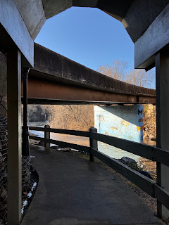
This is on the South Fork of the Shenandoah. Bixler’s Ferry Road crosses on the bridge to the right, but at one time it crossed on that very low bridge in the center. A section of the low bridge has been removed, allowing canoes and kayaks to navigate through. 


There is a parking lot here for people fishing. (I actually have a state fishing license just so that I have a right to park at boat landings while I’m taking pictures. I’ve never been questioned, but I do know a photographer who was instructed to leave a boat landing. Vehicle space is limited and the state wants to have space available for vehicles towing boats.)


I think the ferry landing was located here. I looked for details and found some other information. Bixler’s Ferry was once named Pixler’s Ferry. A man named Peter Pixler lost his pension from the war of 1812 when he changed his last name to Bixler. In 1870, his house was washed away when the river flooded. (Source: Forerunners by Harry Strickler, found on Google Books.) I also saw several publications that mentioned evidence of an Indian settlement and mounds nearby.


February 7, 2025

Around the Mountain to Shenandoah River State Park

Yesterday’s weather was strange: wintry with icy cold rain in the morning, warming up to springlike temperatures in the afternoon. It was my “day off” from Charlie because I had a reservation for him to stay in day boarding. After I picked up a few groceries, I went off to enjoy the afternoon. 

I drove to Strasburg, dropped off donations at the thrift store, and headed to Shenandoah River State Park. It stays open when our local park cannot be reached due to flooded roads, as well as when Shenandoah National Park has to close Skyline Drive due to snow and downed trees. (The mountain tops get hit hard by winter winds and cold temperatures.)

Here we see the visitors center reflected in a water feature.


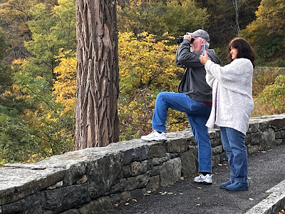
I stopped at Cullers Overlook. A pair of chromatic binoculars are mounted on a stand. These not only bring in distant details, but they are said to help people with color blindness.

From the overlook, we see the South Fork of the Shenandoah curving around a bend. The Massanutten Range is in the distance.


From there I drove south to Luray and took pictures for another post. 

December 27, 2024

Hot Coffee, Winter Sky

Carrying Two Cups


On the day after Christmas, Marie and I went to Front Royal for a little shopping and lunch at Spelunkers. Then I suggested driving to the town of “Little” Washington. By this time she wanted a cup of coffee, and we found a place open in nearby Sperryville. 

We came home by crossing the Blue Ridge to Luray and then wound around to Fort Valley Road, a scenic route that the GPS deems shorter. (I think it saves a couple of minutes if you don’t have to slow down for tractors or wildlife on the road. I avoid it at night though. There are hairpin turns that are tricky in the dark.)

Viewing Page Valley and the Blue Ridge 

We stopped to admire the view from the top of Massanutten Mountain. Marie got out and took a picture. I took one from the car.

December 21, 2024

November 14, 2024

Along U.S. 340 in Page County

Not Far from Luray


Here we see the South Fork of the Shenandoah from a boat landing just off 340 where it bypasses Luray. There’s also a business route 340, the old route that goes through Luray and Stanley. U.S. 340 runs from Greenville, Virginia to Frederick, Maryland, and I’ve traveled all of it at one time or another. It passes through some beautiful country.

I took these pictures at the end of October. I imagine the leaves have fallen since then. We had a frost yesterday, and today there was much-needed rain.


 The third picture is from later that day when I was driving back along 340. In the distance is a peak in the Massanutten Mountains.

Skywatch

October 17, 2024

Camp Roosevelt to Mary’s Rock Tunnel

 Autumn Color Appears in the Mountains 

On Tuesday I set out to look at the early autumn colors. There was a light rain when I left Charlie at daycare, but the forecast just said it was cloudy. Sometimes colors show up well on a cloudy day so I headed for Shenandoah National Park. I have to cross the Massanutten Mountains to get there, and it only takes a few extra minutes to go by way of Fort Valley when I’m headed for the central section of the park. 

I stopped at Camp Roosevelt to eat the small lunch that I had packed. This was the site of the first CCC camp ninety years ago. 


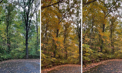
The fall foliage was not showing up in my photos, probably because the rain had just stopped and light was subdued. I looked for adjustments on my iPhone’s camera app and found that there was one for cool versus warm colors. The middle frame (above) shows a picture at full warmth, but that was not realistic. I dialed it back down to capture what I was seeing.


Just east of Camp Roosevelt, I entered the burned area of the forest. It is recovering pretty well because the wildfires this summer took out the underbrush but left many upper branches of trees undamaged.

On the other side of the mountain, I drove through Page Valley, crossing the South Fork of the Shenandoah on Bixlers Ferry Road.


I went through Luray on Route 211 and headed up the Blue Ridge, entering Shenandoah National Park at Thornton Gap. For those who don’t know, the national parks are not the same as the national forests. They are administered by different agencies and have different missions, although there is some overlap in what they do.

The sun was peaking through the clouds by the time I reached Skyline Drive, the beautiful road through Shenandoah National Park. I took about 200 pictures that day, so I’m not going to post all of them. Many are repetitious anyway. In today’s post, I am sharing pictures from the first overlook I reached, the Mary’s Rock Tunnel Parking Area. 


The colors change first at the highest point of the park at Skyland. That’s where I went, but those pictures can wait until tomorrow.

October 6, 2024

A Muddy Boat Landing

Front Royal, VA

There is nice riverfront park at the foot of Luray Avenue in Front Royal. It’s in a floodplain, though, so it is closed when the South Fork of the Shenandoah rises out of its banks. I stopped at the boat landing there on Friday to see if the water had receded. It wasn’t down to the normal level yet, but Eastham Park was open. The boat landing was still largely underwater, with a large muddy area where the water had intruded.
 

There are broken branches in the river resting on the concrete pier, which is still under water. A sign was knocked down, although a picnic table still stands, muddy and warped.


We were fortunate that the Shenandoah Valley was not hit as hard by Hurricane Helene as Southwest Virginia and North Carolina. By the way, Skyline Drive is open, although the Blue Ridge Parkway is closed. It is farther south, starting at Route 250 and winding its way down to North Carolina. You may have seen images of the tragic flooding and landslides in the mountains of North Carolina. 

I am re-sharing summer photos of this boat landing so that you can see what it looks like in nice weather.

Sharing with Mosaic Monday

August 26, 2024

Small but Mighty Mural

Luray, VA


This painting of a raptor is on the side of Broad Porch Coffee. I did not find information on it, but I am going to guess that it depicts a hawk because it is steps away from Hawksbill Creek.


Luray is a small but vibrant town, popular with tourists because of Luray Caverns, and proximity to the Shenandoah River and Shenandoah National Park.

Mosaic Monday / Murals

March 28, 2024

Charred Mountaintops

Massanutten Mountains and the Blue Ridge

A week ago, Virginia was hit with a number of fires on a very windy day. Some of these fires were started by power lines that collapsed when trees blew over on them. At least one fire was started by a vehicle accident. The news reported that in the region from Maryland through Virginia and West Virginia, there were over 100 fires! Although many were put out promptly, some continued to burn for days. In the mountains of Virginia and West Virginia, the fires were difficult to contain because much of the terrain is hard to reach, and our lovely wilderness areas had dry underbrush that fueled the fires.

Firefighters did a great job under difficult circumstances, and managed to protect most structures, although some homes were lost near Strasburg. No fatalities were reported because people evacuated ahead of the flames. Finally, heavy rain came through the area, helping the firefighters to get things under control.


Route 211, the main road from New Market to Luray, was closed to traffic for several days because of a wildfire that burned right up to the edge of it. On the other side of Page County, another fire burned in Shenandoah National Park, causing closure of a 10-mile section of Skyline Drive. 

The first picture shows a burned area along US 211 at the top of Massanutten Mountain. (The green sign marks the county line between Shenandoah County and Page County.) The road formed a fire break, and the firefighters were able to keep the flames from spreading to the other side, at least in most places.

The rest of today’s pictures are from Shenandoah National Park. They reopened the closed area yesterday, and I drove up today, although I knew it would be painful to see. The park is very special to me and I go there frequently. 

Along Skyline Drive, I found a one-mile stretch that showed severe burn damage. It was between mileposts 27 and 28. Although more of the park was burned, that was mostly in wilderness areas. Similar to what I saw on Route 211, the paved road had served as a firebreak, giving the crews a place to stop the spread of flames. 

The trailhead for Neighbor Mountain Trail was scorched right up to the parking lot. There was a strong smell of burnt wood. 

Just north of there is Jeremy’s Run Overlook. The pretty view is looking west. The foreground is blackened from the fire, although there is a strip of green grass next to the parking lot. The Appalachian Trail runs below here and was closed for almost a week. The park service checked the trails to make sure they were safe before reopening them.


The wayside and picnic area at Elk Wallow were not damaged. The final picture is from Little Devils Stairs Overlook, which was not touched by the fire.

Skywatch

There is so much that I could say, but I’m almost overwhelmed by sadness. I am not good at pretending that disaster is not upon us. I don’t like to use this blog to lecture, and my style is usually to present things and let them speak for themselves. But here we are, seeing the effects of climate change. And this is just the beginning.

On my Unreal Images blog. I made a post about Mother Nature. She may not be real, but there is a balance in nature that has been disturbed.

February 15, 2024

Winter Skywatching, Skyline Drive

It wasn't really my plan to go to Skyline Drive today, but my errands took me to Front Royal. Skyline Drive starts there and winds its way south through Shenandoah National Park. Sometimes I find it irresistible.


I knew that they had snow up there, even though we had only gotten a dusting of it in the valley. I told myself that maybe I would just go up and view a few overlooks, and then turn around and go home.


In the winter, it is hard to predict what it will be like in the mountains. The climate there is colder and sometimes foggy. By the time I reached Range View Overlook, I knew that the skies held enough drama to make photography interesting. I decided to drive south to Thornton Gap and come home through Luray.


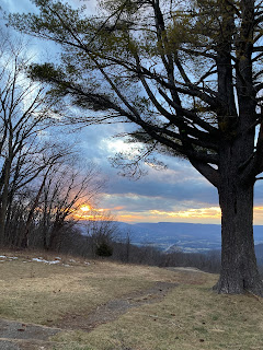
I have driven the north section of the drive so many times that I know which overlooks offer the best views. I usually stop at Pass Mountain Overlook before reaching the exit at Thornton Gap. The sun was low in the sky when I got there.

Ha, the sun coming through the clouds looks like the face of a jack-o’-lantern!