Showing posts sorted by relevance for query port republic. Sort by date Show all posts

April 20, 2008

Field Trip to Port Republic

  • Yesterday I went on a field trip with Blue Ridge Community College. Instructor Rudy Tucker was our leader and van driver. I was one of only four students.

    The subject was the Battle of Port Republic (June 1862). "Port" is one of my favorite small towns and combining it with tales of Stonewall Jackson drew me to this course.
  • a parkOur first stop was the riverfront park in Port Republic. Here our teacher gave a detailed description of the battle using magnets labeled with the names of the military units that were there. This took a while but really clarified the action.
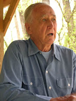
    Rudy Tucker
    teacher

  • Our teacher, now 83 years old, has been a resident of that area for a long time and had permission to take us on farms that stand on the historic battlefield.
cattle farm
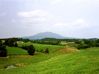
Here we stood on crossed by Confederate soldiers trying to reach the high ground of "The Coaling," which you can see on the upper right.

"The Coaling" is now preserved and marked with signs just off Route 340 near Grottoes. Below is the view from the point where Union artillery stood and was fired on the advancing Confederates.
sign and view
Next we rode to Brown's Gap. If you look closely in the photo below, you can see white rocks right in the middle. That's the remains of Mt. Vernon Furnace. At the time of the battle, the trees would have been cleared to provide charcoal for the furnace.
forest
Finally we stopped at the site of Jackson's Bivouac on June 16, where his army rested before leaving for Richmond and what turned out to be the Seven Days' Battles. This field is clear of trees except for this old giant on the left, known as Jackson's Prayer Tree. You can see it from Rockfish Road near Weyers Cave Road. It's been struck by lightning and trimmed yet it still stands, preserved because of its association with a hero of the Shenandoah Valley.
tree and field
There's another trip scheduled for next Saturday on the Battle of Piedmont but I will not be able to go because we are hosting a library program. See BRCC's special interest classes.

Previous Posts on Port Republic:
  1. By the South River
  2. Madison Hall
  3. Port Republic Trip with NVCC
~For more on the battlefield see the NPS page on Port Republic.
~This SNP hiking guide includes history of Brown's Gap.
~CWPT has a page on The Coaling.
~Our teacher recommends reading Conquering the Valley: Stonewall Jackson at Port Republic by Robert Krick.
FaceTweet it!

July 3, 2012

Reenactment, Battle of Port Republic

150th Anniversary of Jackson's Valley Campaign


The reenactment took place at Cedar Creek Battlefield, far from the original location but still in the Shenandoah Valley. The topography seemed different enough to me that something was lost, although both locations have a farm field and a hill. The actual battle took place near the headwaters of the South Fork of the Shenandoah and the rivers there are impressive; in fact, the water was at flood stage at the time of the battle. A turning point in the battle was the charge against a high hill called The Coaling, which looks like a mountain compared to the gentle hills on this reenactment site (not including the mountains far away in the distance). 

Not that I have anything against Cedar Creek Battlefield; it's a nice place to visit. (Don't miss Belle Grove!) Port Republic is a great place to visit too. Not as much of the battlefield is open to visitors but the town is quaint, the rivers are scenic, and there interpretative signs to help you track the Civil War battle.
See also:

December 13, 2008

Museum in Port Republic

kemper houseHere is the museum in Port Republic, VA. It's not open in the winter but we were fortunate to find it open on a Sunday afternoon in the summer. It's in the Kemper House where Turner Ashby's body was taken after he was killed in the Battle of Harrisonburg in 1862.

I've written about Port Republic several times. (Click to see all my posts on "Port.") We find the town charming and considered purchasing an old home there except for the fact that it had flooded several times.

Recently I submitted a page on the Palmer Lot Marker in Port Republic to the Historical Marker Database. I've contributed other marker photos to that site because I find it to be a useful resource when I'm working on my Civil War field trip pages and also when I'm planning a visit somewhere.

November 30, 2008

Port Republic: Two 19th-Century Buildings


These buildings are across from the park on the South River in Port Republic, VA.

Above we see the old Town Hall.

To the right is the James Patterson log house. It was later owned by Marshall Jones, the first free African-American to be recorded as an occupant in the town.

You can search this blog for other pictures of Port Republic, or just look at the BRCC Field Trip to Port Republic.

March 4, 2008

Madison Hall, Port Republic

This house is perched on a hill just outside "downtown" Port Republic. It was built around 1916 on the site of historic Madison Hall. Right now the house is "under contract" with settlement expected in a month.

On the edge of Main Street in front of the house is a sign summarizing the history of the site.

Madison Hall
Homesite scene of colonial settlement, Civil War clash


The crest of the hill was the site of Madison Hall, built in the mid-1700s for John Madison, the first Court Clerk of Augusta County, which originally included this area of Rockingham County within its frontier boundaries. In response to the presence of unfriendly Indians in the area during the French and Indian War, he built a fortified structure on the corner of the property. Madison's son, James, would become president of William and Mary College in 1777 and the first Bishop of the Episcopal Church in Virginia in 1785. John Madison's cousin was the father of another James Madison who would become President of the United States.


In June 1862, Madison Hall had become the home of Dr. George W. Kemper, Sr. and was serving as Confederate general Thomas J. "Stonewall" Jackson's headquarters. On the morning of June 8, as Jackson prepared for a quiet Sabbath, he was confronted with an emergency. Advance Union raiders had surprised the ill-disciplined Confederate pickets and entered Port. Jackson galloped through the village, pausing at the church on Main Street to admonish one of his staff for cursing. He slipped across the covered bridge on North River with moments to spare, rallied his forces on the far shore, and pushed them into the village to rout the invaders.


As Col. Samuel Sprigg Carroll's Union cavalry charged up Main Street, a skirmish developed. Here on the grounds of Madison Hall, two dozen infantrymen and some raw artillery recruits, under the heroic direction of Confederate Capt. Samuel J.C. Moore, made a brief, brave stand that protected the army's valuable wagon trains and herds of cattle spread behind the house. There is no reliable casualty list from the skirmish, but area diaries recall the excitement, pandemonium, and heroics as civilians sought safety and the Yankees were driven from the village.


In June 1864, Madison Hall was occupied by Union general David Hunter and his staff while their squads were detailed to destroy industries in Port Republic. It served as the residence of four generations of the Kemper family until it was sold in 1908.


November 30, 2008

Palmer Marker, Port Republic


This marker stands in front of the park on the South River at Port Republic, VA. Next to the picture below (of the periwinkle-covered foundation) is the text of the sign.

Palmer Lot at Middle Ford
Ford was site of Jackson's temporary bridge


Parallel to South River is seen the bed of the lower millrace which brought water power to several village industries. The Galliday Tannery was located on the far left; the Dundore/Downs Tannery on the adjoining property on the right. The Robert Waller Palmer house, known as Green Isle, stood between the race and the river. Its foundation, now covered by periwinkle, exceeds the measurement of sixteen by sixteen feet, the minimum allowed size of houses built on the first lots sold in the newly chartered town of 1802.

The ell-shaped limestone foundation near Water Street remains from the mid-nineteenth century house, store and post office of Palmer's son, John. An 1837 invoice describes his merchandise as "French, English, German and American Fancy Goods."

On the site was a slab bridge over the millrace which led to the middle ford of the South River. On June 8, 1862, Union soldiers under Col. Samuel Sprigg Carroll invaded the village by fording South River and cross the bridge. After the Federal invasion had been repelled, Confederates hurriedly constructed a temporary bridge during the night of June 8-9. Captain Claiborne R. Mason's African-American engineer troops performed the difficult job by dragging wagon beds into the flood-swollen river by means of a complicated pulley system, putting rocks atop the wagons, and then fastening lumber together to provide a precarious walkway. The next day Confederate soldiers, hurrying into the Battle of Port Republic raging just downstream, crossed gingerly. Eventually the temporary bridge broke down, leaving many obliged to wade through the deep water, holding their weapons and ammunition up to keep them dry.

Across the street are the Town Hall and the James Patterson log house built in the early 1800s. Patterson's home was later owned by Marshall Jones, the first freed African-American in Port. Also visible are some of the oldest remaining structures in the village.

January 18, 2011

South River in October


We walked around the park in Port Republic (Virginia) in Autumn. These young people showed up; I think they are students. They appeared to be serious and well-organized.

I've posted a number of photos of Port Republic over the past few years. For examples, see November 2008 or October 2008 or just search for Port Republic.

August 22, 2006

Port Republic Field Trip


Today I posted some pictures from a Civil War tour of several years ago, Cross Keys and Port Republic.

These battlefields are in the Shenandoah Valley southeast of Harrisonburg. Port Republic is a quaint village where the North River and South River come together, forming the South Fork of the Shenandoah River.

The rivers sometimes rise up and flood the village. However, this disadvantage has discouraged development and kept the town small and historic-looking.

January 18, 2011

Encore: The South River

south river
I've been to Port Republic many times. It's a small town between two rivers — not much of a port these days, but significant as the beginning of the South Fork of the Shenandoah.

I love the sound of the river — you can hear it by starting the little video.

See also South River at Port Republic, Oct. 2008.

February 2, 2009

My Oddest Ashby Photo

The Historical Marker Database requested a color photo of the Chestnut Ridge marker so I uploaded mine to their site. I also contributed a few related pictures, including this one that I took a few years back in Port Republic, VA.
This exhibit reminds us that the body of Turner Ashby lay in state at the Kemper House, where he was taken after being shot at Chestnut Ridge. Today that same building houses the Port Republic Museum.

February 12, 2017

Along Port Republic Road


Not far from the village of Port Republic stands this large church, the Mill Creek Church of the Brethren. It was organized in 1840. The original church is long gone but it served as a Civil War hospital.

An interesting page on the church's history tells how their ancestors were persecuted in Europe for their beliefs against infant baptism and participation in war, and thus fled to America in 1719 and 1729. (This story is similar to that of some of my ancestors who were Mennonite.)

Across the road from the church is a farm, so I've got pictures to share with the Barn Collective as well as InSpired Sunday


February 15, 2011

New Guide to Virginia's Civil War Sites

I received a complimentary copy of the new edition of Civil War Sites in Virginia: A Tour Guide by James I. Robertson and Brian Steel Wills. I was pleased to get it because I wore out my old copy of the 1982 edition, which I sometimes carried with me on trips to Civil War sites because it gives directions.

This new version includes one of my photographs, a picture of the Kemper House in Port Republic, where Turner Ashby was taken after being mortally wounded near Harrisonburg. They give me an illustration credit on the last page of the book.

October 28, 2008

The South River at Port Republic, VA


Sunday's weather forecast indicated it might be the last warm and sunny day for a while, so we agreed to go out for a drive. I suggested crossing the Blue Ridge to Gordonsville but Frank did not want to go that far. He countered with a suggestion to visit Port Republic, a quaint town situated between two rivers. We've been there a number of times and even considered buying a house there until we heard how deep the floodwaters had risen in the past.

We parked at the community park on the South River and walked around. It's just above the point where the South and North Rivers join to form the South Fork of the Shenandoah. The sound of the rippling water just about drowns out the noise from traffic going over nearby bridge. We watched leaves drop into the river and get scooped up by the current, which swirls them away

Previous Post: South River in Rockingham County

GPS /Location note: On Google Maps, ask for @38.294, -78.814 .

March 4, 2008

By the South River in Rockingham County

Yesterday was warm and sunny. We paid a visit to Port Republic before driving to Harrisonburg for some errands.

We spent a little time by the South River. Just downstream from here, this river joins the larger North River to form the south fork of the Shenandoah.


south river

July 1, 2012

Marching Through Camp

Reenactment in Middletown


The reenactment of the Battle of Port Republic was staged on the Cedar Creek Battlefield in the Shenandoah Valley. This is one of the few battlefields in Virginia that is still suitable for reenactments. Second Manassas will be staged here in 2012, as well as the Battle of Cedar Creek.

July 23, 2013

Down by the Riverside

We took a Civil War tour today, which is the 150th anniversary of the Battle of Wapping Heights. This was the last battle of the Gettysburg Campaign as Lee's army struggled to return to the Rappahannock after being defeated in Pennsylvania.


Here Patrick Farris lectures in front of Riverside, a historic home in Riverton, a community on the outskirts of Front Royal. Lee's army crossed the Shenandoah River near here on pontoon bridges that were put in place by the pioneers, the equivalent of today's Corps of Engineers. Historian Farris explained that Lee's pioneers were made up of free blacks, enslaved blacks, and white men. I was interested to hear this because there's a sign at Port Republic that refers to bridges constructed by Stonewall Jackson's African-American engineer troops, and someone who saw that on this web wrote to me asking if they were free or enslaved and at that time I did not know.
Riverside is privately owned. Earlier in the war it was used by Stonewall Jackson, who briefly headquartered here.

April 5, 2009

A Rockingham County Landscape

Seen Yesterday Near Port Republic, VA

May 7, 2007

Visits Ending

dulles airportTomorrow Frank's sister leaves to fly back to the west coast. Today his brother (and wife and dog) drove back to Pennsylvania after a brief visit. We enjoyed having everyone here and showing them the sights here in beautiful western Virginia.

For instance, yesterday we took everyone (except dogs) to a festival at Blue Ridge Community College, had lunch at Mrs. Rowe's Buffet near Mt. Crawford, drove to Port Republic where a delightful older lady showed us the museum and a sweet couple let us tour their historic house, and stopped at the JMU Arboretum in Harrisonburg for a pleasant walk around the duck pond.

It was a cool day but sunny and gorgeous. The Shenandoah Valley is green and delightful in the spring.

January 16, 2009

Blog Post No. 1700

Hard to believe I've posted 1700 times since I started blogging in 2005. Someone said my blog looked "distinctive". Since the template is only slightly revised from one of the standard ones, I assume the sizing and placement of pictures may be what looks distinctive.

Generally I like photos to be large enough to show some detail, usually "medium" in Blogger terms. Still, small ones can be handy when the detail isn't important, and readers can always click on them to see a bigger version. Keeping them lined up with the text can be tricky, since different-sized monitors change the spacing. I've gotten pretty adept at inserting tables in HTML to line up pictures and text, when I take the time. Tables are fairly simple as long as you work carefully so that you don't split any code in the wrong place.

While I'm writing about the blog, here's a summary of postings for the last three months:

March 28, 2019

New Viewing Deck in Wildwood Park


We've been to Bridgewater many times and it was always a little frustrating that a fence blocked the view of the North River rushing over the dam. Recently the park was improved with an observation platform, making it easy to get unobstructed photos of the river. We stopped by there on Monday to see it.


Rain arrived shortly after we did so we didn't stay long, plus the light was getting dim for pictures. But I'm thankful that the view at this nice park has been improved. The overlook is called Downrush Vista. The roar of the water is a wondrous sound!

From here, the North River flows down to Port Republic, where it joins the South River and becomes the South Fork of the Shenandoah.

Sharing with Fences and Thankful Thursday.