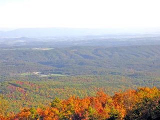
 If you follow Crooked Run Road west from Basye, you will labor up a twisty-turny road, back and forth up Great North Mountain. You leave the farms and rural homes and pass through the George Washington National Forest as you climb upward.
We drove up there Sunday, as far as the West Virginia line at the crest of the mountain. There we found a couple of communication towers and a rough side road that is blocked to vehicle traffic. And nearby is a gas line/utility line cut through the forest, offering views both eastward and westward. The road we were traveling continues on to the Mathias/Lost River area, but we did not venture that far.
The photo below looks east-southeast toward Supinlick Ridge, which is where we live. I believe our home (and Basye) is out of the frame to the right, although it's not visible from that point. From our deck we can see the radio tower ahead and to the right.
 Next is the view in the other direction, looking towards West Virginia.
 According to Wikipedia, Great North Mountain is a 50-mile long ridge.
No comments:
Post a Comment
The View from Squirrel Ridge features thousands of views of the Shenandoah Valley and surrounding area. I post frequently so please visit often.
Your comments are appreciated. If you are responding to a post older than a few days, your comment will be held until we have a chance to approve it. Thanks for your patience!
Sorry, anonymous comments cannot be accepted because of the large number of spam comments that come in that way. Also, links that are ads will be deleted.